How Digital Twins Help Cities Plan Before They Build
A digital model of a city can show where shadows fall, how water might flow and what a new building does to its neighbours before anything is built. It is a planning tool, not a crystal ball, and its value depends on the data behind it.
It’s Important
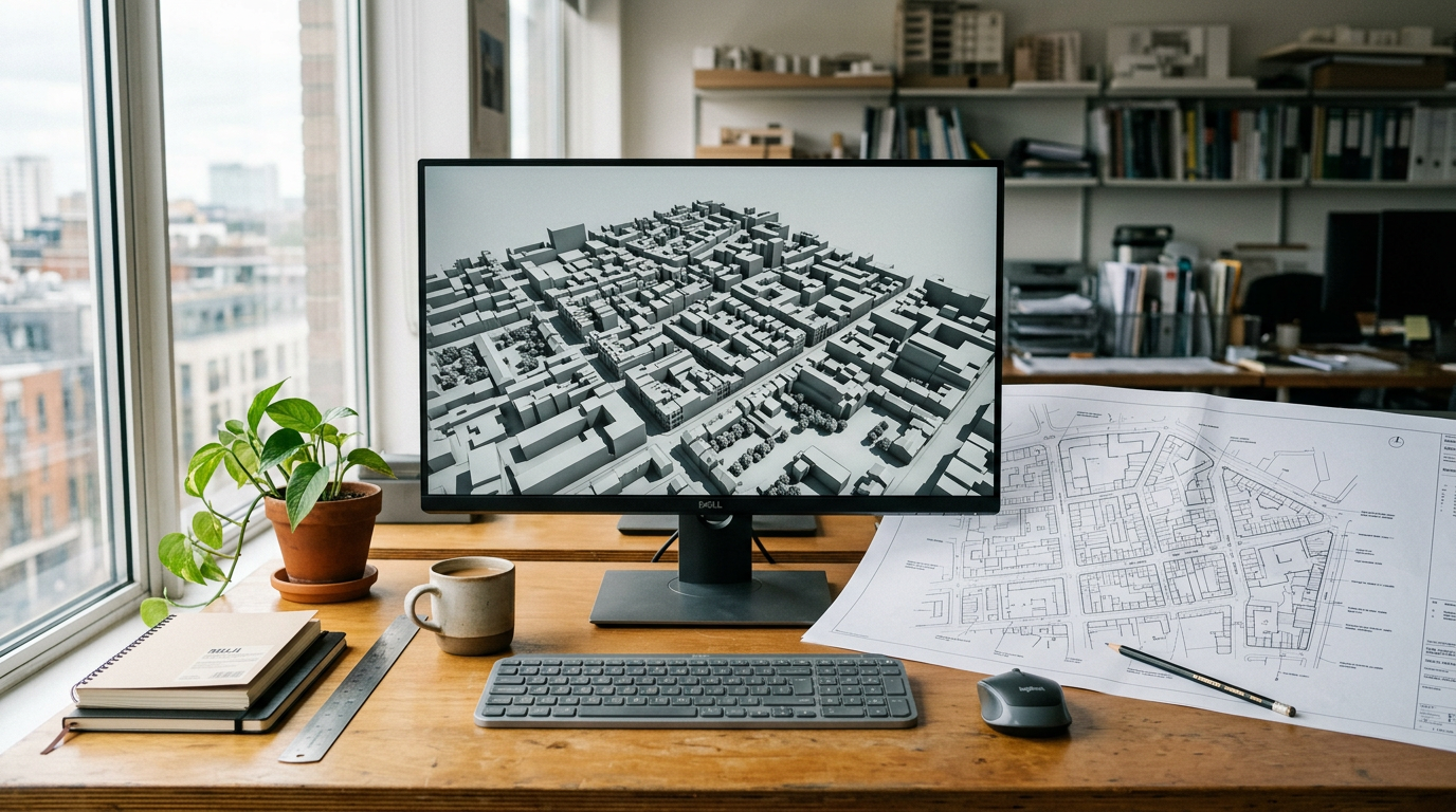
Before a tower is built, someone has to ask what it will do to the street. Will it put a school playground in shadow for most of the winter? Will it channel wind into a plaza? Will the drainage cope with a heavy storm? For most of the history of planning, those questions were answered with drawings, calculations, physical models and experience.
Digital city models add another way to answer them. Many cities and national agencies now maintain detailed three-dimensional models of their buildings, streets and terrain, and some describe these as digital twins. This explainer looks at what such models can actually help planners understand before construction begins, what separates a 3D model from a digital twin, and where the limits lie.
Three things that are often called a digital twin
The term is used loosely, so it helps to separate three ideas.
A static 3D city model is a geometric representation of buildings, terrain and infrastructure at a point in time. It might be built from aerial surveys, laser scanning and building records. It is useful for visualisation and for many analyses, but it does not change unless someone updates it.
A digital twin, in the stricter sense, is connected to the thing it represents. The Gemini Principles, published in 2018 by the Centre for Digital Built Britain at the University of Cambridge, defined a digital twin as a realistic digital representation of physical assets, processes or systems, and distinguished it from other models by its connection to the physical twin. The same report argued that poor-quality data is a major source of inefficiency across the built environment, and set out principles on purpose, trust and function to guide how such twins should be built and shared.[1]
A simulation environment is something else again: a set of models that calculate how a system behaves under given conditions, such as how floodwater spreads, how air moves around buildings or how traffic responds to a new junction. Simulations can run on top of a 3D model or a digital twin, but they are only as good as their assumptions.
Researchers have noted that the boundaries are blurry in practice. A 2020 review of the terminology found no consensus on exactly what constitutes a digital twin for cities. It found the term was increasingly used to describe something more than a 3D city model, including semantic data, real-time sensor data, physical models and simulations, but that "3D city model" remained the dominant term in the geographic information systems field.[2]
A national case: Virtual Singapore
Singapore's Virtual Singapore programme is one of the most frequently cited examples of an attempt to build a national-scale platform. The National Research Foundation's programme page, as archived in March 2023, described it as a dynamic three-dimensional city model and collaborative data platform, including 3D maps of Singapore, intended for use by the public, private, people and research sectors.[3]
According to that page, the project was led by the National Research Foundation, with the Singapore Land Authority providing its 3D topographical mapping data and designated as the eventual operator and owner, and the Government Technology Agency providing information technology expertise. It was described as a research and development programme with a budget of S$73 million over five years, covering both the platform and research into new tools.[3]
The page also explained what "semantic" modelling means in this context. Rather than storing only shapes, the model was to encode information about objects: textures and materials, terrain features such as water bodies, vegetation and transport infrastructure, and the components of buildings such as walls, floors and ceilings. Data would come from multiple public agencies and be combined with existing two-dimensional platforms.[3]
That distinction is what makes analysis possible. A model that knows a surface is a roof, made of a particular material and facing a particular direction, can be used to estimate solar exposure or heat gain. A model that knows only shapes cannot.
The archived page is a statement of intent and design, not an evaluation of results. Programme names, ownership and platforms change over time, and this article does not rely on any claim about Virtual Singapore's current operational status that could not be confirmed from a live official source.
What planners can test before building
With the caveats above, city models support a recognisable set of planning questions.
Shadows and daylight are the most straightforward. Given the geometry of existing buildings and a proposed one, software can calculate where shadows fall at different times of day and year. That helps assess effects on homes, parks and public spaces, and it is a calculation that depends mainly on accurate geometry.
Solar energy potential follows from the same geometry. Roofs and walls that receive more sunlight are better candidates for solar panels, and a city-wide model allows that to be estimated building by building rather than one site at a time.
Heat is harder. Surface temperatures in a city depend on materials, vegetation, shading, wind and human activity. A model can help identify streets and spaces likely to be exposed to high heat, and test the effect of trees or reflective materials, but the results depend heavily on the quality of material and vegetation data and on the physical models used.
Flood risk combines terrain, drainage networks and rainfall. A detailed elevation model can show where water is likely to collect, and coupled with drainage and hydrological models it can test how a new development or a change in surfaces might alter runoff. Here the model is only one input; the drainage data and rainfall assumptions often matter more.
Transport and movement can be studied by combining the city model with network and travel data. Planners can explore how a new station, road layout or development might change flows, though traffic and pedestrian models carry substantial uncertainty about how people will actually behave.
Infrastructure and asset management is where the digital-twin idea is strongest. If a model is linked to records of pipes, cables, roads and buildings, and updated as assets are inspected or replaced, it can support maintenance planning and help avoid conflicts when one utility digs near another.
A 2022 review of city digital twin technology argued that the main advantage is economic, through better planning that saves time and money, but that the useful starting point is a city's actual needs rather than the technology looking for problems to solve. It described a back-end city twin as a container of information, with each front-end application offering a limited but meaningful view of it for a particular purpose.[4]
That framing is helpful. A single city model rarely answers every question. It supports a family of tools, each of which needs its own data and validation.
Open models and local practice
Not every city model is a large national programme. Helsinki, for example, publishes a 3D city model through the City of Helsinki's geospatial services, alongside its other maps and open geographic data.[5]
Publishing models openly can widen their use. Architects, researchers, companies and residents can work from the same base, and errors are more likely to be spotted. It also raises questions about what level of detail should be public, which leads to governance.
Limits: data quality, uncertainty and false precision
The most important limitation is that a model is only as good as its data. Buildings are altered, trees grow and are felled, drainage records are incomplete, and underground assets are often poorly mapped. A model that is not maintained drifts away from the city it describes. The stricter definition of a digital twin, with a live connection to the physical world, is demanding precisely because keeping that connection is expensive.
The second limitation is uncertainty in simulation. Shadow calculations are close to exact if the geometry is right. Flood, heat, wind and traffic simulations depend on assumptions about weather, materials and behaviour, and their outputs are best read as ranges and comparisons between options rather than precise predictions.
The third is false precision. Highly realistic visualisations can make results look more certain than they are. A photorealistic street scene with a confidently coloured heat map invites trust that the underlying model may not have earned. Good practice shows uncertainty, documents data sources and validates results against observations.
The fourth is that technical tools do not settle planning decisions. A model can show that a building will shade a park for two extra hours in December. It cannot decide whether that is acceptable in exchange for new homes. Those judgements remain political and public.
Privacy and governance
As models move from static geometry to live data, they raise governance questions. Sensor feeds about movement, energy use or occupancy can reveal information about individuals and households. The Gemini Principles placed trust alongside purpose and function as a foundation, including the expectation that twins are secure and that data is shared on clear terms.[1]
In practice that means deciding who can access which layers, how personal data is aggregated or excluded, how long it is kept, and who is accountable when a model informs a decision. It also means being clear with the public about what data is collected and why.
What a digital model is good for
Digital city models are most useful when they are treated as shared, maintained infrastructure for asking specific questions, not as perfect copies of the city. They make some analyses fast and repeatable, such as shadows, solar exposure and visual impact. They make others possible but uncertain, such as heat, flooding and movement. And they depend on the unglamorous work of collecting, updating and governing data.
For residents, the benefit is that more consequences of a development can be seen and debated before it is built. For planners, the discipline is remembering that the model is a tool for judgement, not a replacement for it.
Sources & Further Reading
- 1.The Gemini Principles(opens in a new tab)
Centre for Digital Built Britain, University of Cambridge, 2018
- 2.Digital Twins for Cities: A State of the Art Review(opens in a new tab)
Built Environment, 2020
- 3.Virtual Singapore (programme page, archived 31 March 2023)(opens in a new tab)
National Research Foundation, Prime Minister's Office, Singapore (via Internet Archive)
- 4.Digital twin of a city: Review of technology serving city needs(opens in a new tab)
International Journal of Applied Earth Observation and Geoinformation, 2022
- 5.Helsinki 3D(opens in a new tab)
City of Helsinki
- Content type
- Explainer
- Author
- It’s Important
- Published
- Reviewed
- Editorial basis
- Research-based editorial
Filed under Design topic · Cities system
Spotted an error? Report it to us.